|
For those who've been following the daily posts, below is the entire two-week journey in a single chronological post. Wish you could have been there with us! The islands of Aotearoa are well known for being amongst the most geographically diverse and majestically beautiful in the world. This is one couple's journey across them. The South Island 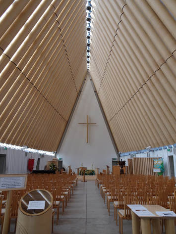 Part 1 As the de facto capital of the South Island, Christchurch is a difficult place to fit into a single mental model. The west side of the city hugs the Avon river, aptly named given the rows of willows gently raking its docile flow. Stone school buildings drawing immediate comparisons to Hogwarts come into view around each corner, and tourists outnumbered by retirees stroll through the generous parklands. Once you turn into the confusing one-way system (no doubt no less taken-for-granted by locals than the hook turns of our own city's centre), you're shunted down streets that could have come from any Australian or small Western European centre with familiar logos filling your view. That is, until you reach the Eastern half where the contrast is as stark as the East-West divide in Cold War Berlin. Big holes, piles of rubble, blocked streets, and construction workers with their heavy equipment fill the large city lots destroyed by earthquake. The cathedral, the city's namesake, half stands, shrouded in scaffolding, temporary fencing, and port-a-loos. Though it's 0900 on a Tuesday in the centre of town, non-construction workers are scarce and even the tradies are not as numerous as we'd have expected. At the far end of the grid we come across the transitional cathedral, a sheer isosceles triangle that looks more at home in pre-European invasion North America than on this side of the Pacific. Inside we happen across a particularly garrulous volunteer guide Alois. He tells us of the cardboard, perspex, and shipping container construction of the building to 132% of the building code. "If the big one hits again, this is the safest place in the city," he boasts. We admire the 5cm thick printed glass windows, the "revolutionary" under-floor heating (his obvious derision of papal infallibility makes me think twice about describing the decidely Ancient Roman origins of the hypocaust), and the carved lectern depicting the now-extinct Haast eagle, from which Prince Phillip himself read a Bible chapter "in the original building, of course". The arrival of the morning tea cake for volunteers is our cue to continue our journey. The road from Christchurch to Akaroa is a winding one, climbing up and down mountains on its way along the peninsula. One of the rewards is the panoramic view across two turquoise blue bays while making one of these descents. Our view being impeded by the incessant rain we quickly hurried on to take refuge in the local deli where we partake of the local produce. Akaroa is a French-influenced seaside town; though some homages (Rue X in place of X street for most of the main street names) are more subtle than others (Le Mini Golf). The main drawcard for us was the Giant's House, a colourful mosaic garden set into the hillside above the town. A labour of love for one of the town's many artists we easily spend an hour and a gigabyte of camera space wandering through the sculptures, trying to decipher the meaning behind some and laughing at others. Though when the rain restarts in earnest and the rainbow umbrella provided by our hosts starts to fail it's time to leave. Distance travelled: 162 km 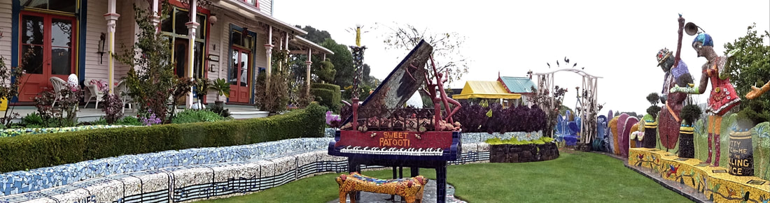 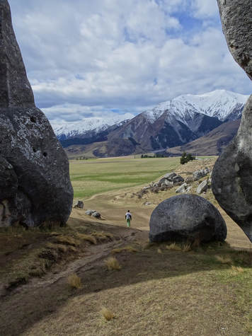 Part 2 A quick stop by the free 15 minute short stay at the Christchurch airport right next to the terminals (Melbourne airport could learn a thing or two here) to update our offline Google maps and we're on our way past our first (of many) sheep pastures of the trip to Castle Hill. A beautiful natural rock formation set in the middle of a high mountain pass, the tourists are few and similarly committed with vans and RVs rather than cars and tourist buses dotting the carpark. Under cover of photography drones shooting from twenty metres up, we pick our way through the monoliths to the top of the hill. I imagine the first English-speakers to come across the area were struck with the image of the ruins of a castle strewn over the top of a hill. The local Maori people have a number of sacred sites amongst the stones and we avoid these on our meander. The view from the top is possibly even more breathtaking than the rocks themselves. Snow-capped mountains sit just across the fields dotted with cows though the winds at the top make extended photo-taking difficult. We soon find ourselves back on the road, once again chuckling at all the signs to "Arthur's Pass" that had the "P" graffiti-ed over. In the same vein, an hour south at the Rakaia Gorge where while eating our lunch the wife comments wryly on the two men and their dog drinking beers in camp chairs next to their four-wheel-drive, "Should have got a jeep". There are many places in New Zealand known to tourists only for their role in the film adaptations of the Lord of The Rings and The Hobbit. Mt Sunday is one such rocky outcrop. At 611m above sea level and barely 100m above the surrounding plain it's nothing special. Except for its role as Edoras in The Twin Towers tourists wouldn't bother visiting it. But being the Tolkien-philes we are, we make the journey across barren ski-fields, floodplains, unsealed roads, and even one rocky ford that tested our rental hatchback's clearance to the purpose-built carpark. I have great respect for New Zealand's Department of Conservation (or Te Papa Atawhai as the signs proudly proclaim), which seems to have pulled off a perfect balance between catering for tourists and environmental preservation. A few bridges and covenant access across private land later we're walking gracefully up Edoras to meet with Theoden in the Great Hall of Rohan. Or at least we would if it wasn't for the innumerable cowpats that doubt the landscape, prompting cries of "These are really hard-working cows!" from the wife. At the top the view is better than the films would suggest, with a 360 degree panorama of snow-capped mountains, the raging Rangitata River and its marshlands, golden fields of waist-high grasses, and grey moraines, their feeding glaciers long gone. It was a good day to be in Middle Earth. Distance travelled: 321 km  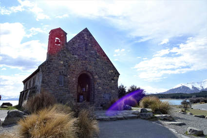 Part 3 Sad to leave the best Airbnb we’ve ever stayed in we take the mountain highway south to Lake Tekapo. One of many high country snowmelt-fed lakes, this lake’s claim to fame is its bright turquoise colour. Apparently the result of suspended minerals only found in the mountains under its feeding glaciers, the colour is a big tourist drawcard. A beautiful church sits on the southern shore with a panoramic view behind the altar across the lake and through to the snow-capped mountain ranges behind including Mt. Cook, New Zealand’s highest peak. Unfortunately the colour is possibly too big of a drawcard and in the half-hour we are there tens of guided-tour coaches disgorge hundreds of tourists who swarm over the rocks, around the nearby memorial, and through the tiny church. We wonder at how many photos and selfies we’ve unwittingly been in the background of, grimace at the tourists taking pictures inside the church despite the ten-odd signs specifically barring this, and groan at the gaudy megaplex of gift store and Southeast Asian restaurants that has sprung up on the shore across the spillway. We later think of Lake Tekapo as the sacrificial anode of the South Island; allowing itself to be thoroughly exploited so that the many hundreds of other not-quite-as-blue lakes may be spared. I'm also reminded of this Blackadder sketch. The thing about mountains (proper ones with snow on the top) is that, according to one of my past geography teachers, “they make the weather all screwy”. So it is with Mt. Cook. While the weather may be bright, dry, and even warm down at Lake Pukaki, barely half an hour’s drive up the winding mountain road to the Hooker Valley and its freezing cold, drizzling, and at times even lightly snowing. The Hooker Valley track is one of those postcard-pretty feathers in New Zealand’s overstuffed cap. But we haven’t the heart to face three hours of walking on ice-covered rock paths in the rain and opt for the Kea Point track instead. Not realising the elevations involved we impress ourselves by quickly reaching a dizzying overlook of the Mueller Lake complete with scree islands and lateral moraine that rivals the neighbouring mountains in height. The glacier may be long gone but its impressive legacy remains. Distance travelled: 445 km 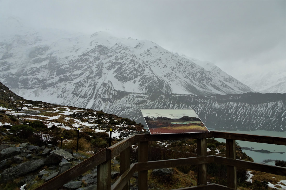 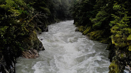 Part 4 Haast Pass is the only way to cross the mountains in the southern part of the South Island. As ways of crossing mountains go it's quite a picturesque way to do so. Not that the drive compares to Arthur's Pass in the north but this highway runs alongside a river valley peppered with pools and waterfalls. Braving the incessant rain we make the short walk off the highway to the so-called Blue Pools. In full flood, swollen by rainwater, the pools were more friendly farmhand brown capped with white foam than the eponymous blue. The tens of cairns on the riverbank suggest the place is a popular spot in the warmer months, but except for one other couple we are the only visitors this time. The stretch of highway we presently come across is known as the Glacier Highway after its most spectacular attractions. The first of these ancient rivers of ice is the Fox glacier. In warmer months it's clearly popular to fly over the glacier or even land on the ice as evidenced by the numerous signs for companies offering these experiences. We've come at the wrong time for these more adventurous activities so we decide to drive up. Finding the northern road closed we take the southern way up to the viewing area but are foiled by the merciless precipitation and make our way back. Halfway back to the highway a moss-covered tree has fallen and blocked the road. Seeing my chance to impress I jump out and set to work clearing the road, at least in as manly way as possible while holding my wife's umbrella printed with cute cat faces and getting soaked all the same. Luckily our excellent Airbnb host has a toasty fire going for us when we arrive and Archer the cat who lives there immediately sets to work keeping our laps warm. Distance travelled: 419 km 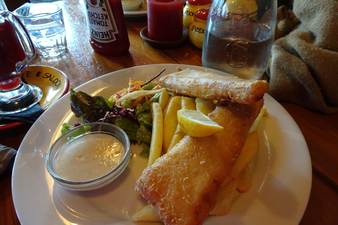 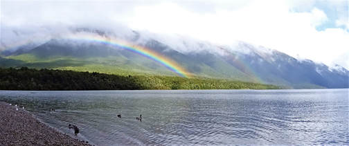 Part 5 A morning spent battling this now familiar rain and a trip to the very underwhelming Sunset Point later we're soon on our way to Punakaiki where the famous Pancake Rocks present some great photo opportunities. As the many helpful information panels show, the rocks were formed by stratified deposition of sediment layers that were then pushed up above sea level by seismic activity and eroded into their present-day shapes. As beautiful as they are, the sea rages all around and that combined with the many tourists taking adventurous photos makes it not a stretch to believe the many signs warning of tourists having fallen to their deaths in the past. The road across county from the West Coast to Picton could be any highway in rural Victoria. Finally far enough away from the mountains that snow doesn't line the horizon the roads are surrounded by low shrubs, backed by groves of tall conifers interspersed with open fields filled with sheep or cattle. The hill is crowned by the town of St Arnaud. This town would be the same as any other in the region if it wasn't for the body of water just south of the main street. Lake Rotoiti (Maori for 'small lake') is a large country lake surrounded by hills and lush forest. We get there just as the sun is coming out from behind the clouds to reveal a bright double rainbow arching over the far hills. While waiting for the Instagramming girls to finish perfecting their selfies we watch the eels from the jetty. The hundreds of eels roiling in the shallows evoke the snakes from Indiana Jones; they are amongst the oldest types of fish and are harmless, yet still they engender fear, their likeness to snakes placing them squarely in the uncanny valley. The Marlborough Sounds are one of the many beautiful natural features of the South Island, yet at night they are barely visible from the ferry. The many photo opportunities go wanting as we cruise across the strait, unaware of the beauty surrounding us. Between an incomprehensible aberration of footy, the comfy couches, and the cafeteria, food wins and a fish and a chips later our journey through the South Island is complete. Distance travelled: 516 km 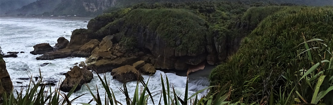 The North Island 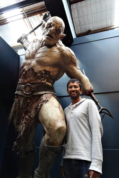 Part 6 As capital cities go, Wellington doesn't stack up too badly. The weather notwithstanding, Sunday mornings find the quayside flush with joggers and dog-walkers keeping fit, enjoying the well-tended water's edge. Open-air markets in the middle of the city bring in fresh produce from all over the region (as well as the obligatory tourist-kitsch) and the latte-sipping set line the sidewalks at the many cafes. But it's not these Melbourne-esque trappings that have drawn us here. The side of a hill at the southern end of the Miramar peninsula boasts a Hollywood-like 'Wellington' sign set onto the side of the hill. Past this sign, a few suburban shops, a dodgy-looking convenience store, and an abandoned-appearing row of warehouses, lies the Weta Cave. Named after one of the many unique-to-New Zealand cave-dwelling insects, the Cave started life as a warehouse where a couple interested in movie special effects could turn their hobby into a (very) successful business. The Cave remains a fairly non-descript warehouse except for the new entrance-way, featuring the three trolls from The Hobbit unlucky enough to be petrified by the morning sun. This studio is the creative effects genius behind Peter Jackson's two film trilogies adapting the works of J.R.R Tolkien (The Hobbit was the first 'real' book i.e. more than I ever read) to the big screen and as such is a mandatory stop for us. As the second group to tour their all-new exhibition area we are feeling extra special. We didn't quite realise the extent of the filmography the Cave has been involved with, movies such as Elysium, District 9, The Great Wall, Warcraft, and Narnia, as well as the ill-fated Halo movie have all had props, sets, or actually filming done by the technicians we meet on the way through. One can even buy movie-exact replicas of the One RIng, Sting, Narsil, and the wife's favourite, Arwen's Evenstar. The items are actually made by the jewellers, swordsmiths, etc. who made the original props for the movie, but at $5,000 for an inscribed One Ring we realise that we'll have to wait until at least one of us finishes their PhD. Our guide actually worked on the Lord of the Rings trilogy and after hanging on his every word we watch The Two Towers with renewed awe at what was one of apparently "the biggest home movies ever made". Distance travelled: 22 km 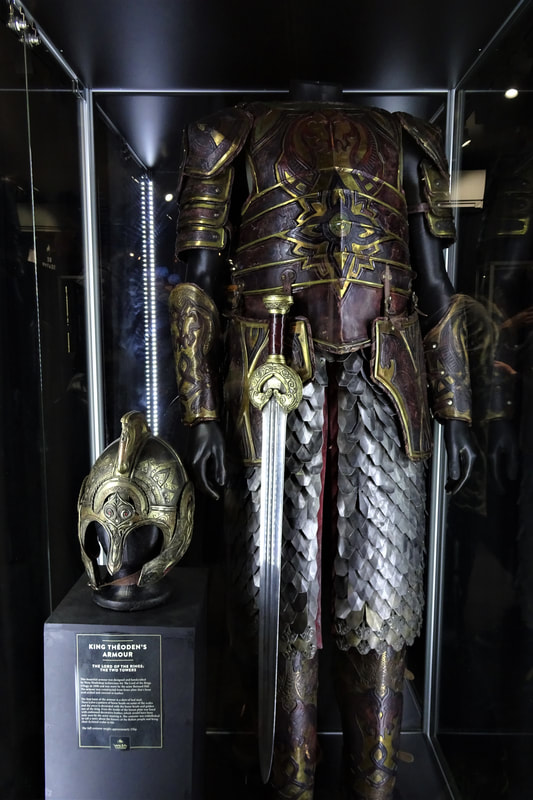 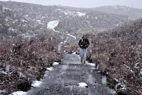 Part 7 Driving across the North Island is quite a different experience to the South. For one thing there're a lot more traffic. Towns are much closer together so speed limits fluctuate down from the 100km/h of the highway more frequently, accompanied by the obligatory "No engine-braking" signs, a concept I don't understand further than that it causes a lot of noise. There are no snow-capped mountains in the distance, at least not at this latitude, and the visible ocean is brighter, bluer, and covered by a much denser carpet of vessels. Approximately four hours north of Wellington are the triple peaks of Mt. Ruapehu, Mt Ngauruhoe, and Mt Tongariro. Stunningly beautiful in their own right, our interest is (as could by now probably be guessed) their Tolkien relevance. Mt Ngauruhoe, the middle volcano of the triplets is filmed as Mount Doom in the Lord of the Rings trilogy and we are keen to pay our respects to Sauron. Halfway to the southern carpark it starts snowing and neither of us having ever been to the snow before, we get out and have an impromptu snowball fight figuring he can wait. The Mangatopopo carpark is the site for the beginning of the Tongariro Alpine Crossing, one of the great walks in New Zealand. 6-7 hours in a single direction in good weather, the walk crosses the northern two peaks across geothermally active fields of hot springs and scree slopes, and would be any Scout's dream to complete. The group of hikers complete with snow gear who finish the walk as we arrive readily attest to this. Mount Doom is obscured by cloud so we resolve to get closer. Setting off in the light snow up the path, barely ten minutes later the path is covered in ice and without crampons and poles it's too dangerous to continue. So we make a snow-Hobbit instead. Distance travelled: 450 km 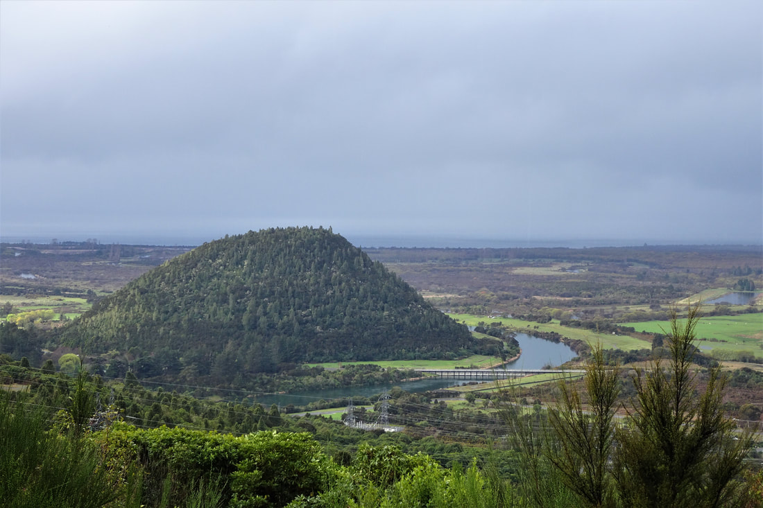 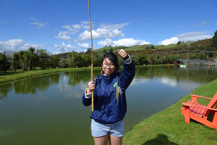 Part 8 The largest lake in New Zealand is Lake Taupo, an old volcanic caldera surrounded by beaches covered in pumice stone. Sacred to the local Maori people who carved giant figures on the faces of some of the islands in the middle of the lake, it is now sacred to the local tourism industry and the adrenaline junkies they serve. Winter finds the many jet boats, skydiving planes, and zorbing tracks operating with reduced hours or not at all. One of the few attractions that are open all year round is the Huka Prawn Park. As a prawn-lover this immediately makes it to the top of the wife's to-do list and we're soon following the giant prawn mannequins that mark the way to the park. apparently one of the only prawn-growing attractions open to the public in the world. Stocked with the fast-growing tropical Malaysian prawn, the park's pools take advantage of its location on a tectonic fault line to get free heating from the local geothermal power plant's run-off. Our guide takes us through the park's history, lets us feed baby prawns (they feel like getting tickled by a bunch of feathers), and teaches us how to fish for them. Then it's into the park for unlimited take-home-what-you-catch prawn fishing. Sitting on the banks with bamboo poles baited with ox heart we resemble garden gnomes waiting patiently for the prawns to bite. Patience is the name of the game when it comes to prawn fishing. The prawns' feeding behaviour is to grab the bait in a claw, move to a secluded location, and toy with it before finally putting it into their mouth. The whole process takes about 3 minutes and in the interim the prawn may get attacked for its food, the bait may become dislodged, or the prawn may get spooked and leave the bait entirely. All this occurs on the bottom of a half-metre deep 20,000 litre turbid pond (just as the prawns love the warm water so do bacteria and plankton) so most of our co-fishers get bored after an hour or so and leave. But we're in it for the long haul and after 3-4 hours we leave with ten prawns full of anticipation for the meal ahead. The Huka Falls sit on the river just down the road from the prawn park and are an impressive site to behold. More violent rapids than falls, 200,000 litres of water flow through a narrow gorge every second and the noise is deafening. Clear, smooth-surfaced water from the river suddenly turns into a churning cyan and white funnel that flows into the river below with an estuary-like colour gradation back to smooth, mirror-surfaced water barely 100 metres downstream. While the wife wanted to take photos from every angle, the Scout in me immediately wanted to kayak down it. So I was disappointed to learn of the strong undertow at the end of the falls that make this impossible in anything less powerful than a jet boat. Distance travelled: 16 km 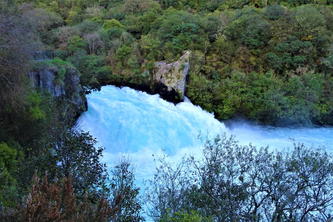  Part 9 As one of the most geothermally active regions in the world, any visit to the central North Island is incomplete without visiting at least one geyser, hot spring, sulphur lake, or eating a steam-hangi. Ever the tourists we planned to do all four and first stop was at the Wai-O-Tapu thermal wonderland. This collection of geothermal formations was originally discovered, our guide tells us following the obligatory saying hello in various languages with a tongue-in-cheek 'Aussie, Aussie, Aussie!' to the always healthy Australian cohort last, by some prisoners. The apocryphal story goes that the prisoners from the newly-built gaol were sent to wash the uniforms at a mineral spring found by the surveyors. When they poured in the washing powder a gush of water sent the clothes flying into the air and them staggering backwards. Remembering their basic physics they piled stones around and on the edges of the spring to make a chimney and did it again, celebrating as the clothes went up nearly ten metres. Prison guards thereafter observed the geyser going off every few days but the intrepid prison governor made a point of inducing the geyser with washing powder for all the visiting dignitaries' (it apparently became a very popular prison to inspect) enjoyment. Over time the silicates and calcium salts built up in a cone shape around the original spring and now we get to enjoy it being induced to shoot water up to twenty metres by the local guides at 1015 every day. The rest of the park truly is a wonderland with walkways wending their way over wickedly-green sulphur-filled waterways. past caves lined with precipitated bright yellow sulphur crystals, and giving wide berths to the steaming ground where hundred of fumaroles vent the boiling underground lake. The biggest drawcard is the Champagne Pool. A thirty metre wide almost perfectly circular pool in the middle of the park is filled with dark green water and ringed by a 30cm wide bright orange shelf, full of arsenic and antimony-containing minerals the signs say, sitting just under the water's surface. The pool gives off a thick plume of steam that intermittently blows across the path, causing the more toxin-conscious of the visitors to dive under their jacket sides like a defendant leaving court or put on their patterned (usually with Hello Kitty) airborne-pathogen prevention masks of questionable value. The Maori culture is a strong one. Having holidayed in, studied, and worked in Indigenous Australia I'm inexorably drawn into making comparisons between the two. While both cultures faced invasions by the same foreign power, one was a heterogeneous group of thousands of tribes with hundreds of languages and minimal concept of property ownership. The other was an almost-homogeneous culture living in fortified settlements with the technology to cross the ocean. There should thus be little wonder at the existence of a Maori TV channel, political party, and numerous 'villages' dotted around the country showcasing the pre-European way of life. Te Puia is one such village. Set around the thermal area that was hot real estate to the local Maori, both literally and metaphorically, its full name is Te Whakarewarewatangaoteopetauaawahiao, literally 'the gathering place for the war parties of Wahiao' who defended the fortified settlement successfully throughout Wahiao's reign as chief. Thermally active areas were so valuable in times go by as they provided hot water to bathe in, cook in, and keep warm by in the winter. The present-day guides are almost all Maori, many of whom descend from Wahiao himself including ours. They take great pride in showing visitors the three erupting geysers, "the only ones in New Zealand" (evidently Wai-O-Tapu's doesn't count), the boiling mud pools and the historical Maori settlement. Opting for the full experience ticket we are guided round the park, treated to a cultural performance at which I perform a quite fearsome haka (the wife may not have thought so), enjoy a sumptuous hangi (underground geothermally-heated Dutch oven) feast, and then watch the geysers doing their thing under the stars, or at least the ever-present clouds of steam. Distance travelled: 82 km   Part 10 Finally the day the wife had been waiting for, our trip to the Hobbiton movie set that cemented New Zealand's place in the world consciousness as Middle Earth. Unfortunately the rain caught up with us, we had literally been out-driving the northward-moving cloudfront since leaving the south island, but we went along all the same. The story goes that Peter Jackson and his location scout were flying a helicopter around the country looking for movie locations and when they saw the Alexanders' farm with the rolling hills, lake, and large tree (the three features from Tolkien's original description of Hobbiton) they landed and discovered it was perfect. So it was that the original Hobbiton set came to be for the Lord of the Rings trilogy, with no trace left at the end of filming. When Peter Jackson returned with a plan for The Hobbit trilogy the owners jumped at the opportunity and a more permanent set was built that tourists can now enjoy. One of the most visited attractions in New Zealand, thousands of visitors roam the tracks of The Shire every day. Our initial experience was marred by the rain (thankfully the tour provides large umbrellas), screaming children, and the combination of a too-large group and narrow paths meaning we could only just hear the guide. A stop at The Green Dragon inn and a free beer marks the halfway point of the tour and losing most of the group at this stop as well as the sun coming out meant our latter experience was much better. The level of detail maintained in the set many years after filming is marvellous. We picked out the jobs of each hobbit hole's owner, tried to find one of the thousands of individually-painted leaves from the set's only synthetic tree, picked which of the vegetables in the patches were fake and which real (most were real), and traded stories with our guide and fellow tourers of which Tolkien movie sites we'd visited. All in all a great experience, just one for summer at a very early timeslot when it's less busy. Perhaps the most famous of the many thermal baths in Rotorua is the Polynesian Spa. It's said that a Catholic priest from a nearby town who suffered greatly with arthritis was brought to the springs to bathe. Following this his arthritis was apparently cured and he walked the many kilometres home. The feeding spring became known as the Priest Spring and the town received international publicity as a spa town. Visitors flooded in, despite the pervasive smell of rotten eggs that the sulphur-laden steam spreads through the town, and a reputation was cemented. The first pool in the adult section is an off-putting green but the warm water soon wins our trust and we make our way around the eight or so pools. Nice, definitely, but somehow underwhelming when we think of our own Peninsula Hot Springs. These tourists just don't know what they're missing out on. Distance travelled: 146 km  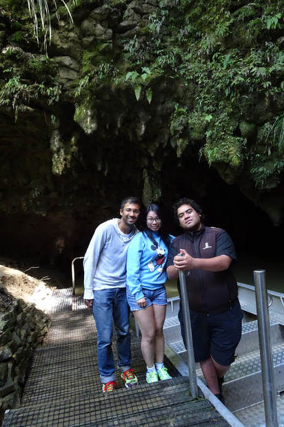 Part 11 Cave environments are renowned for their micro-ecosystems full of plants, insects, and animals that may never see the light of day. The Waitomo caves on the west of the North Island are no different. Their main claim to fame are the thousands of glow worms that light up the cave roof for our enjoyment. Run by a large Maori family of which our guide is a member, the caves see hundreds of tourists daily making their way down the installed staircases to 'the cathedral' cavern where Dame Kiri Te Kanawa once performed. Our group could only manage a weak 'Twinkle, twinkle little star' despite our guide's emphatic urgings to test the "amazing acoustics" and we're soon on the underwater river being pulled along the ropeway in pitch darkness. Presently, our eyes adapt to the gloom and we see that the roof of the cave is covered with thousands of blue lights. These represent the bioluminescent ends of the three-centimetre long glow worms burrowed into the cave. The lights lure any insects unlucky enough to fly into the cave to entangle themselves in the glow worm's mucinous feeding line and be hauled in for consumption. Glow worms live like this for 8-10 months before pupating into adult flies. The flies have no mouth or stomach so only have a few days to avoid their fellow worms' feeding lines, find a mate, get to a spare bit of cave roof, and lay eggs before dying of starvation. When one of the 50-100 eggs in a clutch hatches it devours all the rest, sets up a feeding line, and the cycle continues. Outside the cut-throat cave environment the Waitomo area is surrounded by lush rainforest and tall hills that provide great views of the surrounding area (covered in the dung of hard-working cows of course). It's a great area to have a picnic by the river in the shade of the silver ferns, New Zealand's national emblem, and we make the most of it before starting the long anabasis to the more civilised territory of Auckland. Distance travelled: 336 km 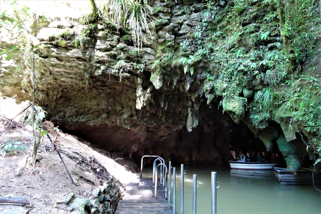 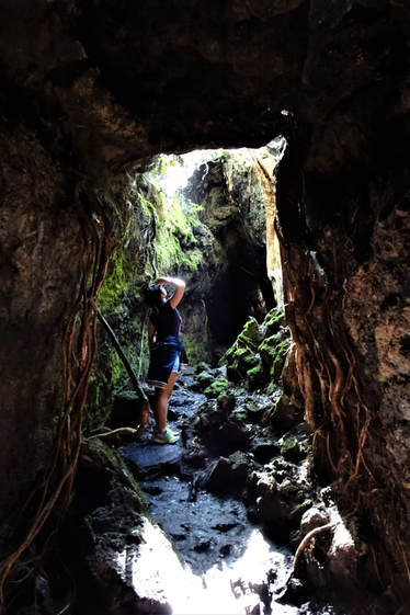 Part 12 Much like our home country, New Zealand’s land area is predominantly large farms and public land of various descriptions (national parks, state-managed lakes, etc.), dotted by small towns. Large towns are few and far between but where they do occur they are sprawling metropolises complete with all the problems this entails. With few incentives to increase population density, like Melbourne, Auckland has grown out into endless suburbs that melt into the bordering farmlands for tens of kilometres in all directions. The heart of the city sits in two parts across the bay that lies at the city’s centre, connected by the Auckland Harbour Bridge (a small rip-off of the Sydney Harbour Bridge as per the wife). Taking after Sydney again the bay-side suburbs are connected by commuter ferries that cut criss-crossing white swathes through the blue-green water sprinkled with the sharp lines of motorboats and yachts, occasionally gashed by a container ship. Taking advantage of the weather having finally passed us by we take one such ferry to Rangitoto Island. Barely twenty-five minutes from the main ferry terminus this three-hundred metre high dormant volcano sits brooding on the horizon and the ferries there are filled with young couples and families out to enjoy the sunshine. There is quite the line already formed on the jetty when we arrive, evidently many people have much more advanced circadian rhythms than ours, and we comment wryly as our walk down the jetty resembles an activewear fashion parade. A brisk hour’s walk over black lava fields and a lot of mental hat-tipping once more to the Department of Conservation for their balancing of accessibility and minimal impact finds us at the top of the summit crater and the view is breath-taking. With the Sky Tower as its centrepiece Auckland wraps around the bay, backed by barely visible snow-capped mountains to the south and an archipelago of islands to the east. Boats, cars, and planes inch along below and around us, evoking memories of Hamburg’s Miniatur Wunderland. All too soon it’s time to leave and an aggressive pace lets us see where some rainforest has started to encroach on the lava fields in the six-hundred odd years since Rangitoto’s last eruption before the ferry carries us back home in the gathering twilight. Distance travelled: 34 km 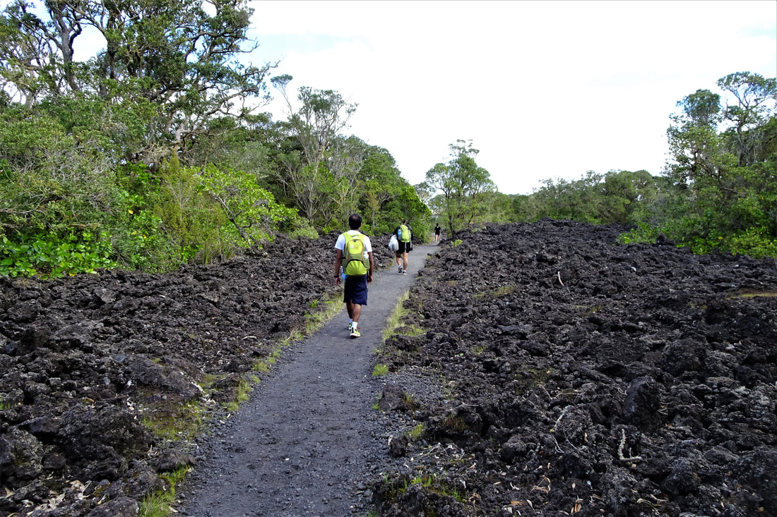 Part 13 As amazing as Google Maps Offline is, it clearly wasn’t designed to reckon with the many one-way streets of New Zealand’s metropolitan areas. A frustrating hour spent crossing the city (the wife feels cheated that in taking lane 2 across the Harbour Bridge we don’t get to go under the coat hanger structure itself) gets us to the seaside village of Devonport. The ferry would have taken less than half the time but ever the tourists we opted for the scenic route. The main street is a mixture of the eclectic natural remedy stores, art galleries, surf shops, and fish and chip-serving holes in the wall that populate any seaside town in the Anglosphere, with the creep of gentrification obvious in the 30-dollar-a-main brasseries and hotels that line the shore. One bookstore in particular catches our eye and after some browsing we’re excited to unearth copy 74 (of 500) of Captain James Cook’s journal from the HMS Resolution. At $1,200 I’m sorely tempted but luckily they don’t accept my card and with temptation behind us we make our way to North Head. As early as the 1800s, New Zealand’s government was concerned about the possibility of invasion by Russia. Auckland being a likely target, the government of the day built fortifications to the east of Devonport with both swivel and disappearing guns set into the hillside. World Wars I and II saw them reactivated to counter the possibility of attacks from the Central or Axis Powers, especially after the WWII mini-submersible attack on Sydney. But no aggressors ever came and the troops and guns long gone, scattered locals now filter through the bunker tunnels and across the parade ground on their afternoon strolls, enjoying the peaceful sunshine. We follow suit and on finding some large pieces of cardboard on a particularly steep hill I do what any responsible Scout would do; pick them up and use them to slide-board down (the wife disowns me at this point of course). Part 14 Across the Firth of Thames from Auckland lies the Coromandel Peninsula. Purporting to be home to the best beaches in New Zealand we can’t let this claim go untested and drive the two hours through farmland and along winding coastal road to the eastern side. A pianist with a travelling piano-on-wheels serenades us with classical ambience as we make our way from the car park, high on the edge of a cliff, down to the Peninsula’s most well-known feature. Cathedral Cove is the Coromandel’s poster beach and rightly so. Deep yellow sand stretches for almost fifty metres to the water’s edge where a huge natural rock arch bends over the beach to form a wide rock cavern. At one end of the cove a monolith bookends the beach while at the other a blind-ending cave is set into the rock next to a waterfall cascading down from the farmlands above into a shallow pool that drains to the ocean. The wife sets about capturing the best photos of all these natural wonders while I set to creating an alternative drainage channel for the waterfall’s pool. This accomplished (and having again been disowned by the wife) we enjoy a pleasant lunch atop one of the rock overhangs. Well as pleasant as is possible when under siege by the local seagull flock. It’s a little known secret that New Zealand’s geothermal activity spreads this far north but that it does and locals derive great pleasure from this. The aptly named Hot Water Beach has two thermal springs running under the beach into the sea and for two hours either side of low tide, locals and more intrepid tourists can dig their own sand-ringed pools atop the springs to take full advantage of the heat. Local convenience stored and beachside peddlers do a roaring trade in heftily marked-up spades but we’re soon rueing our thrift when we realise than channelling a cold waterfall’s pool by hand is one thing but digging a sand-pool by hand that’s been geothermally-heated to 65 degrees Celsius is quite another. Luckily we’re able to take advantage of one group’s pool being too hot to channel their in-flow into a pre-dug now-cold pool and soon we’re all wallowing in thermal bliss, listening to the waves crashing a few metres away. Evidently some people have relaxed a little too much and when I smell the fermenting compost-like reek I’ve been told is marijuana, in the words of Matchbox 20, “You don’t have to go home but you can’t stay here”. Part 15 And just like that our trip across New Zealand is complete. Up winding mountain roads, across ancient lava flows, through snow and driving rain, and cruising in the glorious sun like the Fellowship before us we’ve now been there and back again. As Gandalf the Grey once said while trekking under these lands, “All we have to decide is what to do with the time that is given to us”. We’re glad (and thankful to have even been able) to have spent our time here in the way we did and make memories that will not soon be forgotten. We’ll be back (probably with children and in that case definitely with an RV full of books and board games) but until then every time we have a hot bath or stand atop a hill, the wind full in our faces, we’ll think of you Aotearoa. 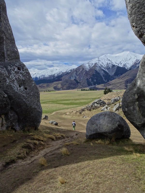
0 Comments
The islands of Aotearoa are well known for being amongst the most geographically diverse and majestically beautiful in the world. This is one couple's journey across them.  Much like our home country, New Zealand’s land area is predominantly large farms and public land of various descriptions (national parks, state-managed lakes, etc.), dotted by small towns. Large towns are few and far between but where they do occur they are sprawling metropolises complete with all the problems this entails. With few incentives to increase population density, like Melbourne, Auckland has grown out into endless suburbs that melt into the bordering farmlands for tens of kilometres in all directions. The heart of the city sits in two parts across the bay that lies at the city’s centre, connected by the Auckland Harbour Bridge (a small rip-off of the Sydney Harbour Bridge as per the wife). Taking after Sydney again the bay-side suburbs are connected by commuter ferries that cut criss-crossing white swathes through the blue-green water sprinkled with the sharp lines of motorboats and yachts, occasionally gashed by a container ship. Taking advantage of the weather having finally passed us by we take one such ferry to Rangitoto Island. Barely twenty-five minutes from the main ferry terminus this three-hundred metre high dormant volcano sits brooding on the horizon and the ferries there are filled with young couples and families out to enjoy the sunshine. There is quite the line already formed on the jetty when we arrive, evidently many people have much more advanced circadian rhythms than ours, and we comment wryly as our walk down the jetty resembles an activewear fashion parade. A brisk hour’s walk over black lava fields and a lot of mental hat-tipping once more to the Department of Conservation for their balancing of accessibility and minimal impact finds us at the top of the summit crater and the view is breath-taking. With the Sky Tower as its centrepiece Auckland wraps around the bay, backed by barely visible snow-capped mountains to the south and an archipelago of islands to the east. Boats, cars, and planes inch along below and around us, evoking memories of Hamburg’s Miniatur Wunderland. All too soon it’s time to leave and an aggressive pace lets us see where some rainforest has started to encroach on the lava fields in the six-hundred odd years since Rangitoto’s last eruption before the ferry carries us back home in the gathering twilight. Distance travelled: 34 km  The islands of Aotearoa are well known for being amongst the most geographically diverse and majestically beautiful in the world. This is one couple's journey across them. 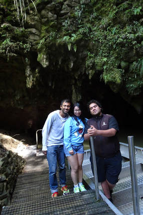 Cave environments are renowned for their micro-ecosystems full of plants, insects, and animals that may never see the light of day. The Waitomo caves on the west of the North Island are no different. Their main claim to fame are the thousands of glow worms that light up the cave roof for our enjoyment. Run by a large Maori family of which our guide is a member, the caves see hundreds of tourists daily making their way down the installed staircases to 'the cathedral' cavern where Dame Kiri Te Kanawa once performed. Our group could only manage a weak 'Twinkle, twinkle little star' despite our guide's emphatic urgings to test the "amazing acoustics" and we're soon on the underwater river being pulled along the ropeway in pitch darkness. Presently, our eyes adapt to the gloom and we see that the roof of the cave is covered with thousands of blue lights. These represent the bioluminescent ends of the three-centimetre long glow worms burrowed into the cave. The lights lure any insects unlucky enough to fly into the cave to entangle themselves in the glow worm's mucinous feeding line and be hauled in for consumption. Glow worms live like this for 8-10 months before pupating into adult flies. The flies have no mouth or stomach so only have a few days to avoid their fellow worms' feeding lines, find a mate, get to a spare bit of cave roof, and lay eggs before dying of starvation. When one of the 50-100 eggs in a clutch hatches it devours all the rest, sets up a feeding line, and the cycle continues. Outside the cut-throat cave environment the Waitomo area is surrounded by lush rainforest and tall hills that provide great views of the surrounding area (covered in the dung of hard-working cows of course). It's a great area to have a picnic by the river in the shade of the silver ferns, New Zealand's national emblem, and we make the most of it before starting the long anabasis to the more civilised territory of Auckland. Distance travelled: 336 km  The islands of Aotearoa are well known for being amongst the most geographically diverse and majestically beautiful in the world. This is one couple's journey across them. 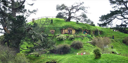 Finally the day the wife had been waiting for, our trip to the Hobbiton movie set that cemented New Zealand's place in the world consciousness as Middle Earth. Unfortunately the rain caught up with us, we had literally been outdriving the northward-moving cloudfront since leaving the south island, but we went along all the same. The story goes that Peter Jackson and his location scout were flying a helicopter around the country looking for movie locations and when they saw the Alexanders' farm with the rolling hills, lake, and large tree (the three features from Tolkien's original description of Hobbiton) they landed and discovered it was perfect. So it was that the original Hobbiton set came to be for the Lord of the Rings trilogy, with no trace left at the end of filming. When Peter Jackson returned with a plan for The Hobbit trilogy the owners jumped at the opportunity and a more permanent set was built that tourists can now enjoy. One of the most visited attractions in New Zealand, thousands of visitors roam the tracks of The Shire every day. Our initial experience was marred by the rain (thankfully the tour provides large umbrellas), screaming children, and the combination of a too-large group and narrow paths meaning we could only just hear the guide. A stop at The Green Dragon inn and a free beer marks the halfway point of the tour and losing most of the group at this stop as well as the sun coming out meant our latter experience was much better. The level of detail maintained in the set many years after filming is marvellous. We picked out the jobs of each hobbit hole's owner, tried to find one of the thousands of individually-painted leaves from the set's only synthetic tree, picked which of the vegetables in the patches were fake and which real (most were real), and traded stories with our guide and fellow tourers of which Tolkien movie sites we'd visited. All in all a great experience, just one for summer at a very early timeslot when it's less busy. Perhaps the most famous of the many thermal baths in Rotorua is the Polynesian Spa. It's said that a Catholic priest from a nearby town who suffered greatly with arthritis was brought to the springs to bathe. Following this his arthritis was apparently cured and he walked the many kilometres home. The feeding spring became known as the Priest Spring and the town received international publicity as a spa town. Visitors flooded in, despite the pervasive smell of rotten eggs that the sulphur-laden steam spreads through the town, and a reputation was cemented. The first pool in the adult section is an off-putting green but the warm water soon wins our trust and we make our way around the eight or so pools. Nice, definitely, but somehow underwhelming when we think of our own Peninsula Hot Springs. These tourists just don't know what they're missing out on. Distance travelled: 146 km 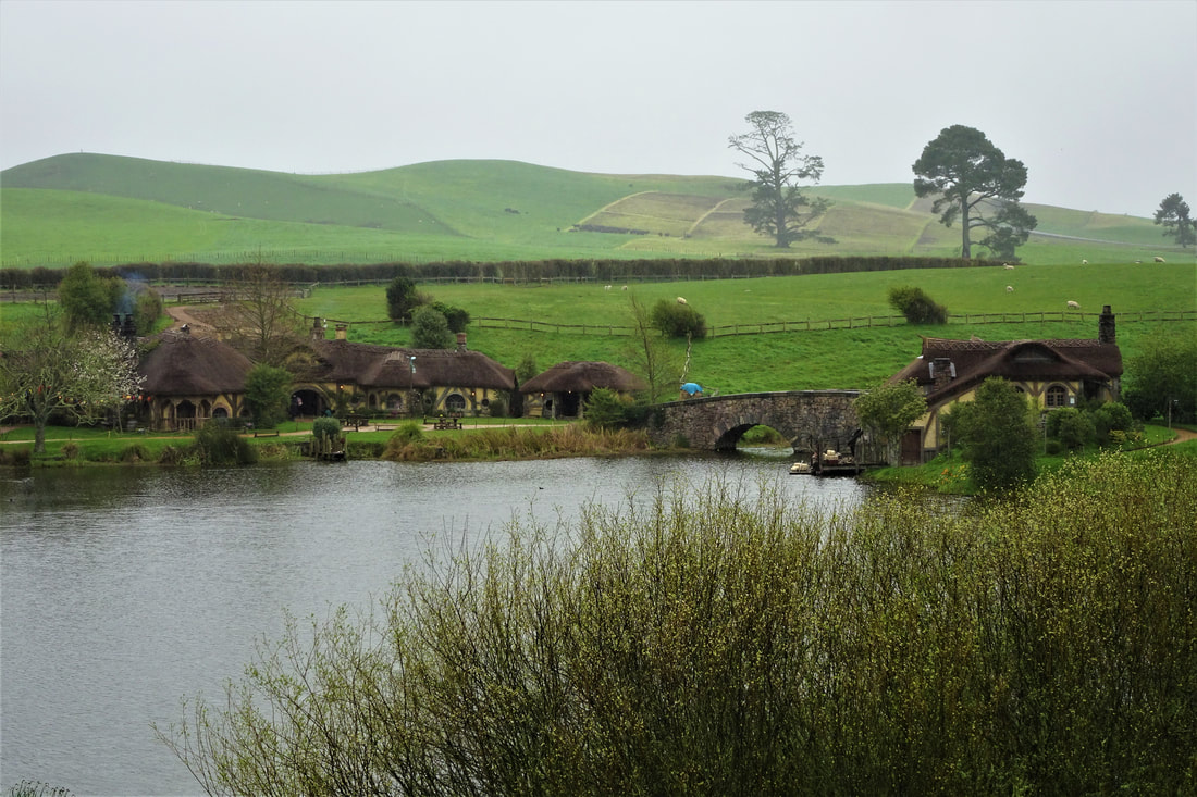 The islands of Aotearoa are well known for being amongst the most geographically diverse and majestically beautiful in the world. This is one couple's journey across them. 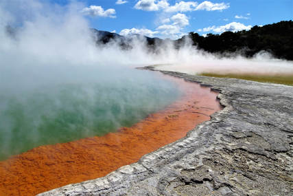 As one of the most geothermally active regions in the world, any visit to the central North Island is incomplete without visiting at least one geyser, hot spring, sulphur lake, or eating a steam-hangi. Ever the tourists we planned to do all four and first stop was at the Wai-O-Tapu thermal wonderland. This collection of geothermal formations was originally discovered, our guide tells us following the obligatory saying hello in various languages with a tongue-in-cheek 'Aussie, Aussie, Aussie!' to the always healthy Australian cohort last, by some prisoners. The apocryphal story goes that the prisoners from the newly-built gaol were sent to wash the uniforms at a mineral spring found by the surveyors. When they poured in the washing powder a gush of water sent the clothes flying into the air and them staggering backwards. Remembering their basic physics they piled stones around and on the edges of the spring to make a chimney and did it again, celebrating as the clothes went up nearly ten metres. Prison guards thereafter observed the geyser going off every few days but the intrepid prison governor made a point of inducing the geyser with washing powder for all the visiting dignitaries' (it apparently became a very popular prison to inspect) enjoyment. Over time the silicates and calcium salts built up in a cone shape around the original spring and now we get to enjoy it being induced to shoot water up to twenty metres by the local guides at 1015 every day. The rest of the park truly is a wonderland with walkways wending their way over wickedly-green sulphur-filled waterways. past caves lined with precipitated bright yellow sulphur crystals, and giving wide berths to the steaming ground where hundred of fumaroles vent the boiling underground lake. The biggest drawcard is the Champagne Pool. A thirty metre wide almost perfectly circular pool in the middle of the park is filled with dark green water and ringed by a 30cm wide bright orange shelf, full of arsenic and antimony-containing minerals the signs say, sitting just under the water's surface. The pool gives off a thick plume of steam that intermittently blows across the path, causing the more toxin-conscious of the visitors to dive under their jacket sides like a defendant leaving court or put on their patterned (usually with Hello Kitty) airborne-pathogen prevention masks of questionable value. The Maori culture is a strong one. Having holidayed in, studied, and worked in Indigenous Australia I'm inexorably drawn into making comparisons between the two. While both cultures faced invasions by the same foreign power, one was a heterogeneous group of thousands of tribes with hundreds of languages and minimal concept of property ownership. The other was an almost-homogeneous culture living in fortified settlements with the technology to cross the ocean. There should thus be little wonder at the existence of a Maori TV channel, political party, and numerous 'villages' dotted around the country showcasing the pre-European way of life. Te Puia is one such village. Set around the thermal area that was hot real estate to the local Maori, both literally and metaphorically, its full name is Te Whakarewarewatangaoteopetauaawahiao, literally 'the gathering place for the war parties of Wahiao' who defended the fortified settlement successfully throughout Wahiao's reign as chief. Thermally active areas were so valuable in times go by as they provided hot water to bathe in, cook in, and keep warm by in the winter. The present-day guides are almost all Maori, many of whom descend from Wahiao himself including ours. They take great pride in showing visitors the three erupting geysers, "the only ones in New Zealand" (evidently Wai-O-Tapu's doesn't count), the boiling mud pools and the historical Maori settlement. Opting for the full experience ticket we are guided round the park, treated to a cultural performance at which I perform a quite fearsome haka (the wife may not have thought so), enjoy a sumptuous hangi (underground geothermally-heated Dutch oven) feast, and then watch the geysers doing their thing under the stars, or at least the ever-present clouds of steam. Distance travelled: 82 km 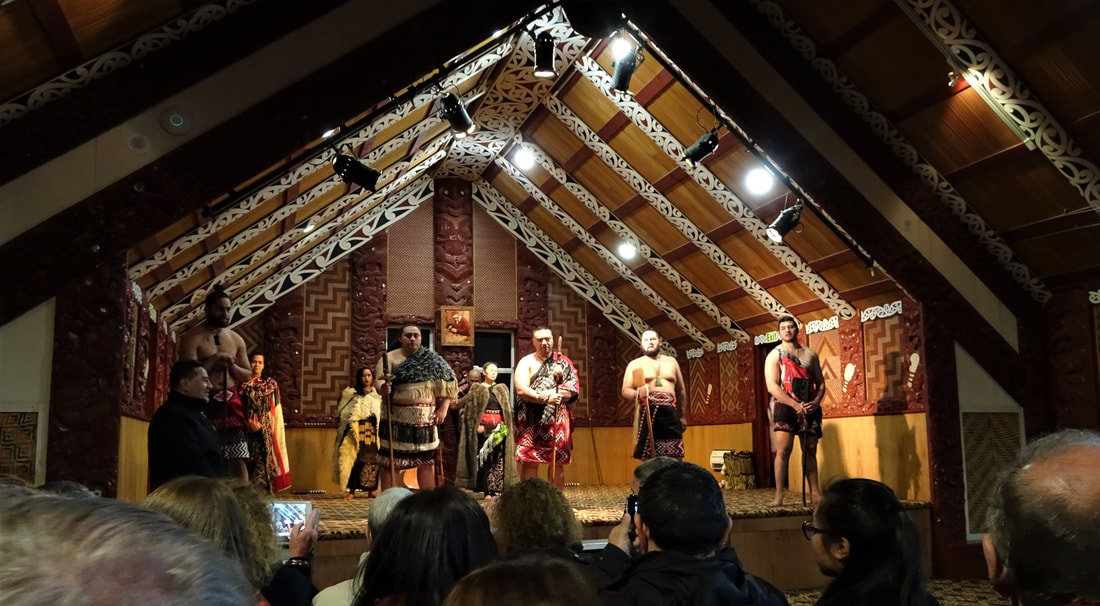 |
DownloadsCheck out the downloads on the next page. Archives
May 2020
Categories |
 RSS Feed
